How do I read it?
Each of the three novels can be viewed in a narrative view
and a map view.
Narrative View
Map View
How do impressions of a city perceived in fiction change depending on author, time and
narration?
The project Novel City Maps visualizes spatiality and its relation to the story
in Berlin novels in the form of poetic maps that originate from the complex tissue
of the underlying stories.
by Jan-Erik Stange
Berlin by the Book
Explore the three Berlin novels Berlin Alexanderplatz by Alfred Döblin, Alone in Berlin by Hans Fallada and Berlin Blues by Sven Regener as Novel City Maps.
The following prototype is part of a research project and we are interested in your feedback! It would be great, if you could spend 5 minutes to answer the questionnaire after you tried it out!
How do I read it?
Each of the three novels can be viewed in a narrative view
and a map view.
Narrative View
Map View
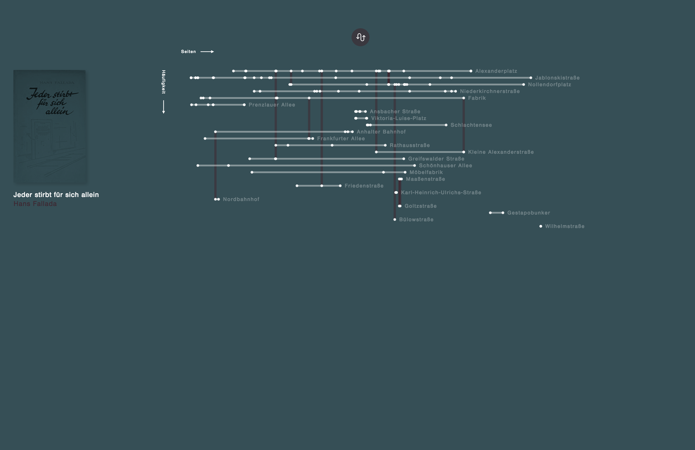
Narrative View
The narrative view shows all the mentions of places in the respective novel and draws connections between the places that are mentioned in conjunction in paragraphs. The graphical system is a reminiscence of the typical transit map and brings to attention the movement of the story and often sudden change between places in the narrative.

Each mention of a place is represented by a white circle.
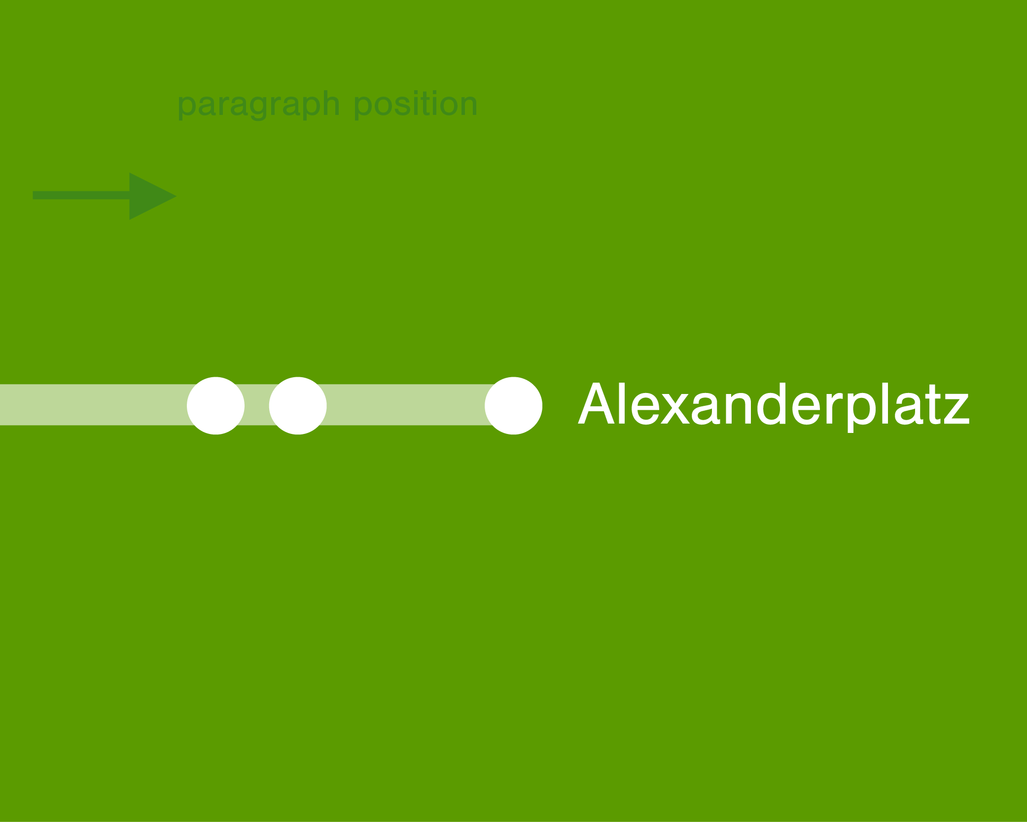
Mentions of the same place are connected to form a »transit line«. The horizontal position of the circles represents the position of the paragraph in the book.
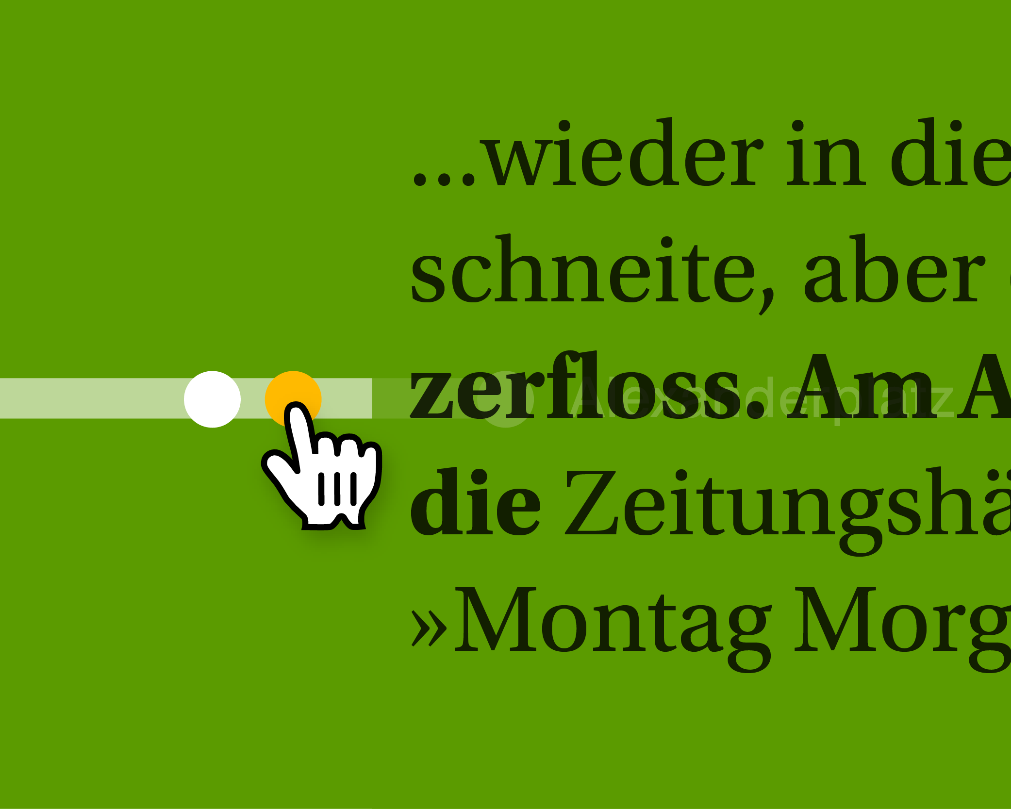
Hovering over circles lets you read the place mention in context.
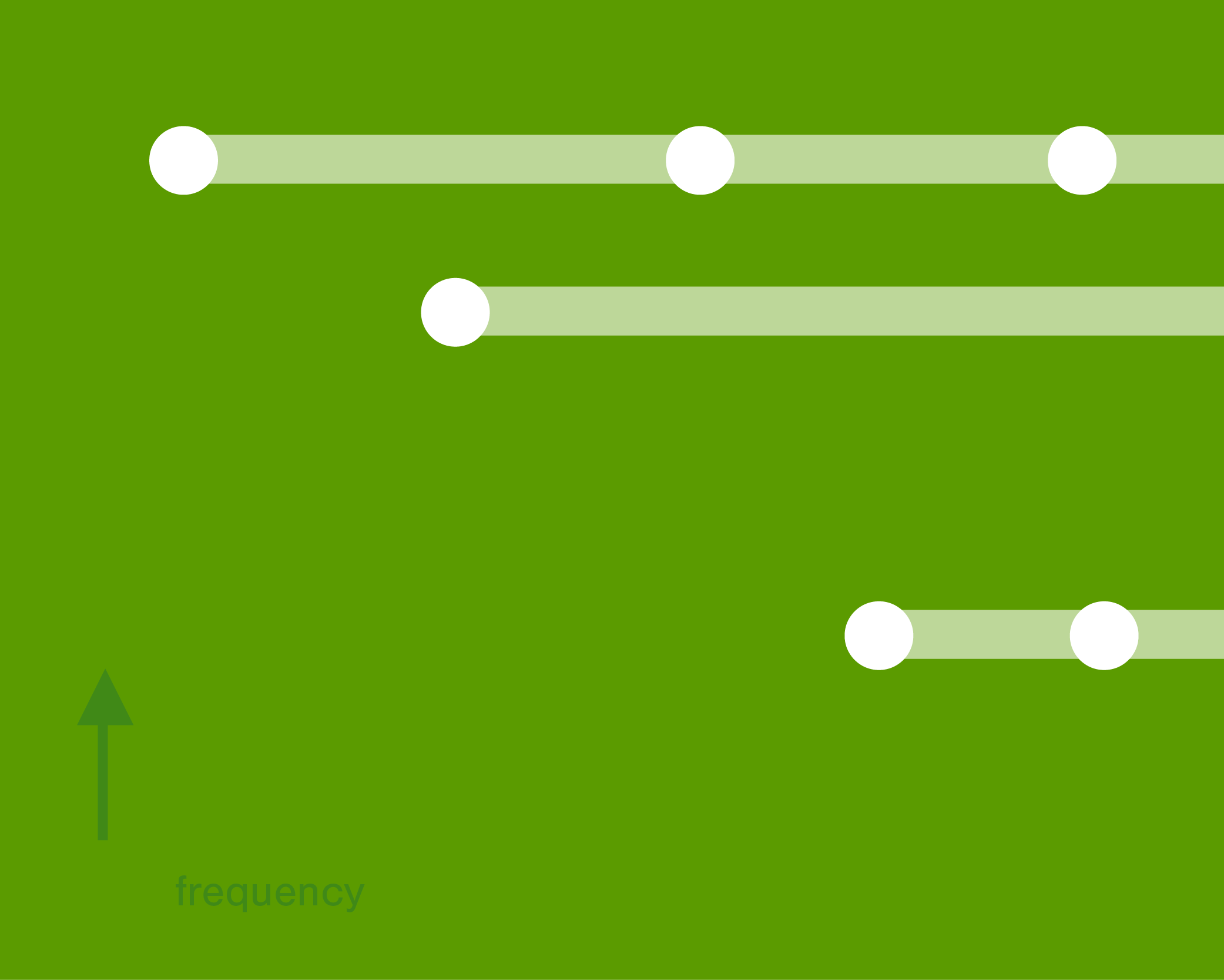
The vertical position of the streets shows the frequency of the place in the book.

Different places mentioned in conjunction in a paragraph are connected by vertical lines.

When hovering over streets the connections to other streets at particular paragraphs are highlighted.
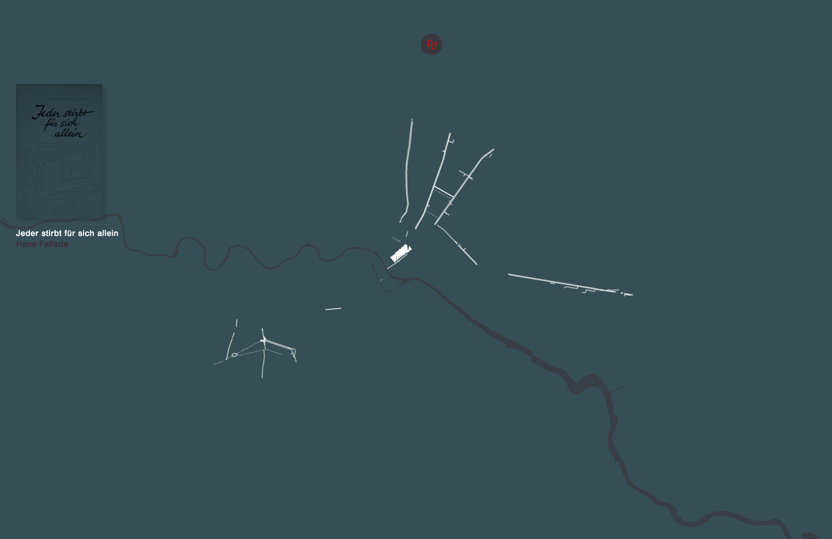
Map View
In the map view the reader is presented with a geographical display of the areas that are prominent in the story. Only streets and squares that are mentioned in the novel are displayed in the map. Those places that are more frequent appear brighter, resulting in a unique spatial fingerprint of the respective novel. For example, for Berlin Blues we can see two little islands in the west Berlin neighbourhoods Charlottenburg and Kreuzberg where most of the plot is located. Since the story takes place during the 1980ies, when the Berlin wall was still up, the eastern part is practically non-existent on this map.
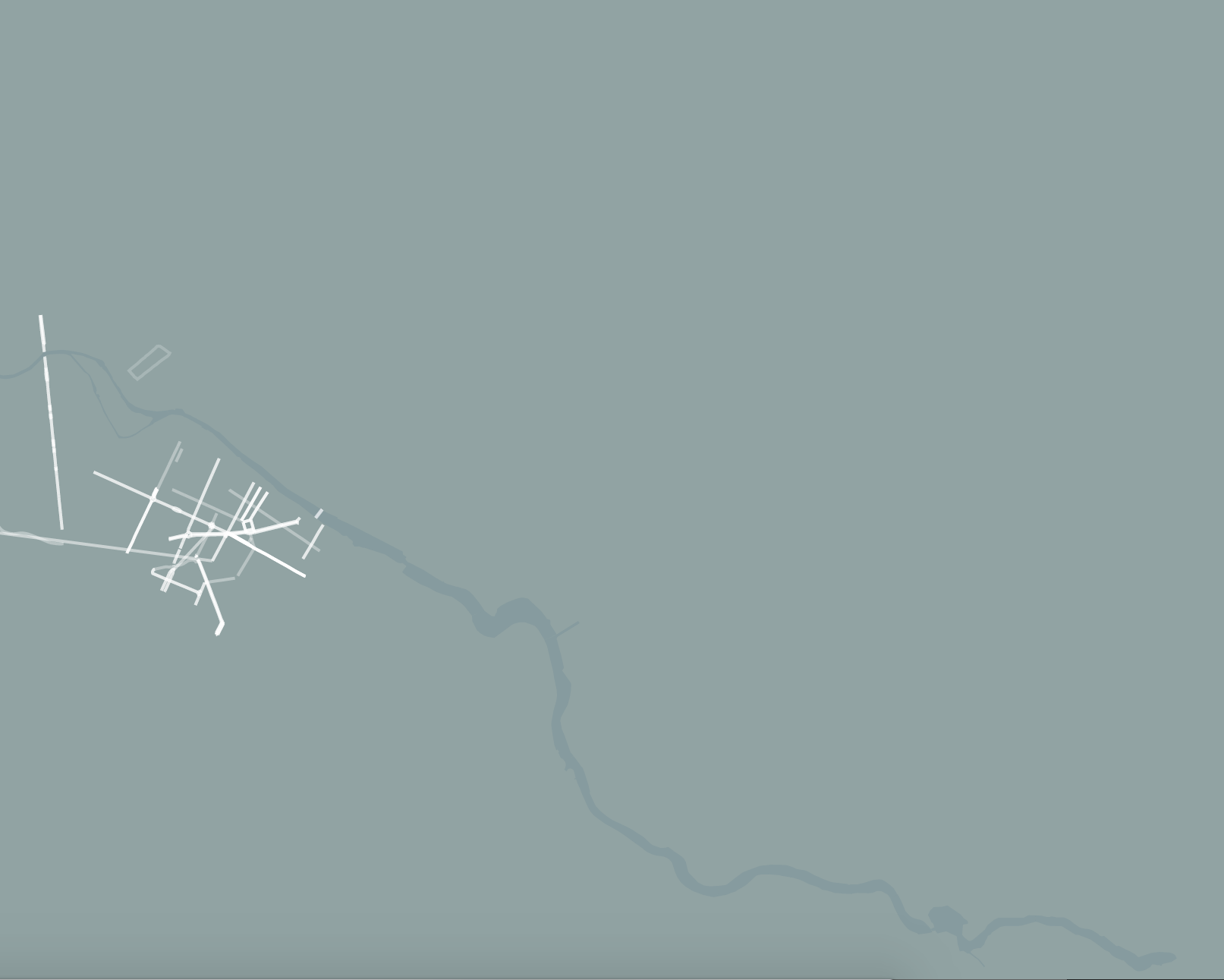
Mentioned streets are shown in white on the map.
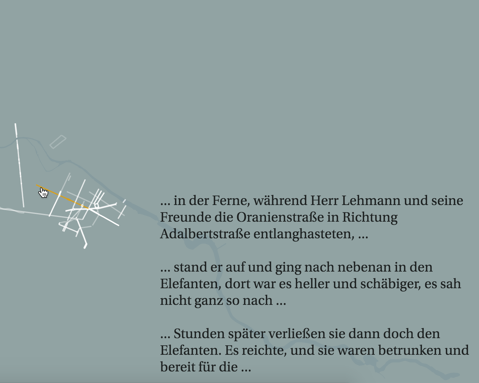
Hovering over streets brings up all the contexts, in which this location is mentioned.
Background
Novel City Maps is part of a dissertation project that explores new ways of visually representing the construction of fictional and geographical space in literature. The project investigates how such kinds of visualizations might be beneficial to literary scholars. Preliminary surveys have shown their benefit for identifying patterns of relations between locations and spaces that are mentioned in close proximity in the text.
As each fictional text produces a distinct map that can be compared with other Novel City Maps of a particular city, the importance of places and locations and their connection becomes visible and the influence determined by story, author, time and other factors becomes accessible to visual analysis. Apart from serving as a professional tool for experts, these visual depictions might also help interested readers get a better sense of the spatiality in novels. Readers are put into the position to explore and read a novel “by the locations”.
This might help people already familiar with the novel to gain a new perspective and possibly a deeper engagement with a book on the one hand,
while on the other hand it might also convince people unfamiliar with a book to read it because they have a connection to certain locations or are interested in the particular spatial pattern a novel produces.
In the current prototype three popular Berlin novels have been selected that each present a very distinct view of Berlin at different times. The novels vary widely in terms of topics, style and narrative features the authors employed. The city of Berlin lends itself particularly well to a spatial literary analysis, considering the many radical social, economic and political changes and developments the city has been subjected to in the last century.